PROJECT RI
Harness The
Hurricane
The first 42-hour early warning system for Rapid Intensification.
The first 42-hour early warning system for Rapid Intensification.
Crowd-flagged RI candidates cross-checked against San Antonio, TX as the reference metro for Gulf–Atlantic approach geometry.
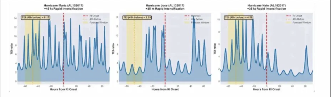
+120 mph in <36 h · Cat 1 → Cat 5 · HURDAT2 / SHIPS-RII RI class
~1,100 mi ESE of San Antonio
Explosive growth outran operational timelines — establishes the need for 42+ h cascade lead time
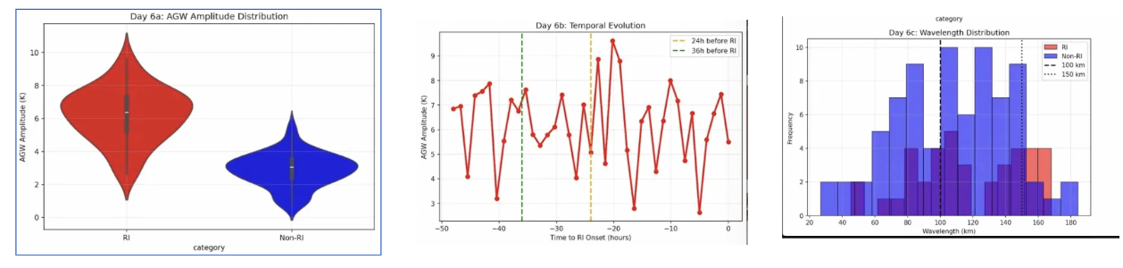
Deep-core ice / rainwater structure before ΔV · Atlantic · citizen-visible
~1,850 mi ENE of San Antonio
Visual precursors ahead of anemometers — matches community flagging workflow
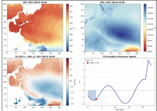
Stratospheric gravity waves · time-lagged before wind spike
~1,280 mi ESE of San Antonio
Causal gate for the thermodynamic cascade — waves intensify before winds
35 kt · Gulf of Mexico · sheared
610 mi SE of San Antonio
Early TEI only · 205 flags / 24h · updated 3h ago